

Mount Saint Helens
Our Mount Saint Helens climb was a sudden plan. We had wanted to do the climb for some time and the limiting lottery permit system would go into effect May 15-two days from now. These factors became our motivation to make the trip a quick reality. The only problem was arranging work schedules to take the time off. However, with a bit of finagling we were able to pull it off. We have since climbed Mount Saint Helens numerous times, but our first is one of the most memorable.
On Wednesday night we drove from Portland to the climber’s register near Lake Merwin, Washington to obtain our permit for the climb the following day. Luckily, Kristen had done all the food organization a few days prior, so we didn’t have any food shopping to worry about. We went straight up to Marble Mountain Snow Park, the highest paved part of the mountain. At 2670 feet, Marble Mountain Snow Park is used as a cross-country skiing and snowmobile area during the winter months. This time of year it serves as the trailhead for climbers. After getting our bearings, we found a nice little secluded spot nestled back in the trees to settle in for the evening. Kristen prepared a delicious dinner of grilled chicken burritos with sprouts, avocado and tomato. Then, at nightfall, we went to bed in the back of our truck anxiously awaiting our adventure tomorrow.
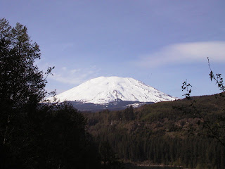
We woke at 5:00 am to eat cold sandwiches of hard-boiled egg and sausage on bread. We then organized our packs and were off. There was one mile of forested trail before we reached snow. Another mile brought us to tree line at 3600 feet and a beautiful view of the mountain. Mount Saint Helens presented itself before us, looming above the landscape in a snowy shroud. Although the mountain changed a lot after its eruption in 1980, it is still climbed every year. On the morning of May 18, 1980, a magnitude 5.1 earthquake triggered the collapse of the summit and north flank of the volcano and formed the largest landslide in recorded history. Gas rich in magma and super-heated ground water trapped inside the volcano were suddenly released in a powerful lateral blast. A plume of ash and pumice billowed out of the volcano reaching a height of 15 miles and transformed day into night across eastern Washington. In less than three minutes 230 square miles of forest lay flattened. Hot gas and magma-melted snow covered the volcano. The resulting floodwater mixed with the rock and debris created concrete-like mudflows that scoured the valleys surrounding the mountain.
The forests have made a strong comeback since the eruption 24 years ago. Kristen and I now hiked up these “tunnels” that had been scoured by the mudflows. “Worm tubes,” as they are now called, are giant half pipes of volcanic rock and are the quickest access to the glaciers. We soon reached the snow and took a much-needed rest. The sun shone brilliantly and there wasn’t a cloud in the sky. Contently, we lunched on dried prunes, snickers and peanut butter.
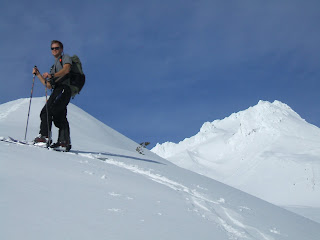
Swift Glacier is the shortest route up the mountain. Once on it, we began kicking steps in the snow as we climbed upwards in a zigzag fashion. We had crampons with us, which are spikey metal devices that attach to one’s boots for traveling up ice and hard snow. However, to our delight, we didn’t need them due to the soft snow conditions and moderate slope. Our progress uphill was not slow going. The wet spring snow offered firm footing for our boots. Our gain in elevation was 1200 feet per mile at this point. The sun shone fiercely and it soon became brutally hot. Sweat dripped off our noses as we trudged upwards and onwards.
We took another break at 6400 feet above sea level. We stood on a snowy slope peppered with rock strands that looked as if they had just recently poked their heads out of a wintery hibernation to see the first signs of spring. We could clearly see Monitor Ridge to our west, which offered many potential descents perfect for skiing. We noticed a few slide avalanche remains (mainly clumps of snowy remains at the bottom of chutes), but not too many. Most slides were on typical 35-45 degree slopes. Our ascent route remained on Monitor Ridge and out of harms way. On the snowfields to our right and left we began to notice a few S-shaped turns in the snow undoubtedly from skiers or snowboarders on their joyous descent.
By nine o’clock clouds began forming; puffy Simpson-like clouds in the distance. We used ski poles to aid us in balance and to take some of the work off our legs. They are a great aid for climbers. We also had ice axes to use in the event that the slope became more steep or icy. However, the spring snow remained soft. The challenge remained one of endurance: to continue pushing on. With each rest break we looked back at our progress. The distance to the summit was slowly shortening while the trees from where we had come disappeared behind us.
By ten o’clock the sky to the south was very dark and clouds began to surround the mountain. To the east, Mount Adams was shrouded in white. However, the summit of Mount Helens remained clear, for now. The forecasted good weather seemed to be deteriorating quickly. The mid-day showers, which are so common in the mountains, were upon us. We were at 7200 feet above sea level and the summit looked just within reach. We could make out the ridge that would take us there. Now, it seemed to be a race against the weather to gain the summit before clouds blanketed our desired view. We took one more long rest in the snow, drank some water, ate a few snacks and then we were on our way.
During the last two miles we used existing steps that had been previously kicked into the snow. This made our traveling much faster. The slope to the summit steepened ever so slightly. Our elevation gain on the last mile was 2500 feet. Even so, we were pleasantly surprised at the moderate slope. We had encountered no crevasses and there was no place where we felt the need to use our ice axes. However, dark clouds began to wrap around our mountain. Above and below us was becoming white.
With a last effort we made the summit at noon. To our delight, we witnessed clear skies to the north. We had climbed 5650 feet in six hours. Standing upon a snowy cornice, we looked down into the crater. Below us, 1900 feet down, was the “lava dome,” a rocky plug from which steam and gasses still seeped. Also below, was the north-facing amphitheater, formed by the crater walls. In the constant shade of the amphitheater, a growing mass of stone and ice has begun to form North America’s youngest glacier. To the east and west were jagged slabs of rock and ice. To the north was a gaping U-shaped hole, nearly a mile across, that had been blown out the side of the mountain during the eruption. We could see the smooth debris path that had been made as mudslides had gushed into the Windy Ridge drainage to the northeast. It was a most spectacular sight.
We enjoyed our view atop the crater rim for nearly fifteen minutes before the clouds completely blanketed or view. We were now inside the clouds. Since we couldn’t see anything we sat down in the snow to enjoy a well-deserved rest and snack. Our stay at the summit was a blissful half hour as we waited for our window. When a break in the clouds did appear, we began our descent via Swift Glacier to the south. I snowboarded while Kristen glissaded, using her ice axe as a break. The snow was perfect; a few inches of day-old snow on top of the winter’s accumulation. There were no rocks or chop. I carved several turns then stopped to wait for Kristen. She slid, upright and feet first, down the slope towards me. She held her axe to the side with the spike at the ready. Should she need it, she could plunge the spike into the snow to slow her descent. I could hear her laughing all the way down.
We repeated this ten or twelve times: me shredding down three or four hundred feet then stopping to wait for my climbing partner. I had a blast spraying the heavy wet snow with each turn, picking my way down the glacier. Kristen, also, had a riot; it was the longest sled run ever. As we descended down and out of the clouds, the view became brighter. We could again see Mount Adams with its peak wearing a cloudy hat. Together, we stopped occasionally, to take in the view around us. We didn’t want it to go away too quickly.
We reached tree line again at three o’clock in the afternoon. I had snowboarded 4400 feet without lift lines or crowds of people. Even though I had only one run, it was ten times more rewarding than any ride at the local ski area; and that is the difference between seekers of wilderness and their pseudo counterparts. A mountaineer is one who seeks the freedom of the hills, full wilderness citizenship with all its privileges and rewards, responsibilities and demands. Later in the afternoon, as we returned to our vehicle after our eleven-hour climb, a fitting Walt Whitman quote jumped out in my head, “And now I know the making of the best people. It is to live in the open air, and to eat and sleep with the earth."


No comments:
Post a Comment